Thinking about a hillside home with views, quieter nights, and quick access to parks and trails? Upper Rockridge gives you that North Oakland blend of nature, privacy, and proximity to College Avenue and Montclair Village. You want the real picture of daily life, from microclimates and stairs to schools and commute options. This guide walks you through the essentials so you can decide if the neighborhood fits your routine and goals. Let’s dive in.
Upper Rockridge at a glance
Upper Rockridge refers to the residential slopes above Rockridge’s College Avenue, climbing toward the Berkeley–Oakland hills. It is an informal neighborhood name within the broader Rockridge area, not an official boundary. You’ll feel close to the energy of College Avenue yet set back on calmer, hillier streets. For context on Rockridge overall, see the area overview on Wikipedia.
The College Avenue corridor and Rockridge BART act as the main transit and retail anchors for the area. Montclair Village sits a short drive uphill. If you value easy access to rail and shops, you’ll likely orient toward College Avenue and Rockridge BART for errands and weekday commuting.
Hills, weather, and microclimates
What the terrain feels like
Daily life here happens on slopes. Streets curve and climb, many homes sit above the road, and public stairways stitch together shortcuts between blocks. You trade flatland walkability for a hillside rhythm that comes with views and more privacy.
Microclimates in action
The Oakland–Berkeley hills create quick shifts in temperature, sun, and wind from one block to the next. South-facing homes tend to feel warmer and brighter, while north-facing hollows can be cooler, especially in the evening. Expect occasional canyon winds and cooler nights compared to the flats. These patterns are well documented in regional planning resources like the Bay Area Greenprint.
Homes and architecture
Vintage meets contemporary
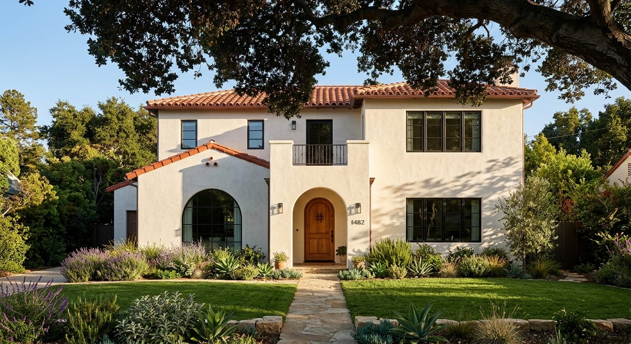
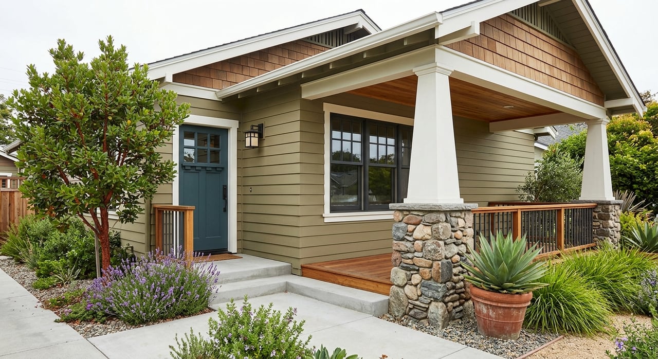
Upper Rockridge shows a mix of early 20th-century Craftsman, Mediterranean, and Tudor styles alongside newer construction. After the 1991 Oakland hills fire, some streets saw larger rebuilds and contemporary designs optimized for views. The result is a block-by-block blend of vintage charm and modern, view-forward homes that often feature expansive decks and large windows.
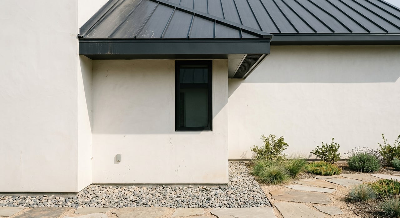
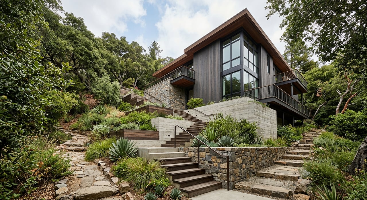
Lot shapes and outdoor space
Lots are typically sloped and terraced. You’ll see multi-level entries, retaining walls, and stair approaches from parking to the front door. Outdoor space often steps down the hill, with decks and patios oriented toward bay, bridge, or downtown vistas. If you love indoor-outdoor living and sunset views, this is a signature perk of the neighborhood.
Parks, trails, and weekend fun
Lake Temescal sits right on the neighborhood’s northern edge and offers loop trails, picnic lawns, and seasonal beach and swim access. It is the easiest green escape for a quick walk, jog, or family picnic. Get details on hours and current advisories at Temescal Regional Recreation Area.
For bigger trail days, Joaquin Miller Park has miles of hiking and biking routes, amphitheater events, and shaded picnic spots. It is a quick drive and makes a great gateway to the East Bay’s interconnected ridgeline systems. Explore the city’s overview of Joaquin Miller Park.
Shops and daily errands
You’ll likely split your errands between College Avenue and Montclair Village. College Avenue offers a walkable main street experience with cafes, grocery options, and services, anchored by Rockridge BART for quick regional access. Montclair Village delivers a compact, village feel just up the hill. Which area you use most depends on your exact block, your parking situation, and how you like to move through your day.
Getting around and commuting
Most residents combine a short drive with BART for weekday trips to Downtown Oakland, San Francisco, or the Peninsula. The Rockridge BART station is your primary rail node. AC Transit routes along College and Claremont connect you to nearby neighborhoods.
If you drive, Highway 24 and Highway 13 are the main freeway arteries. Note that hillside streets can be narrow and winding, and driveway grades may affect vehicle selection and guest parking. Commute times vary widely by departure time, school drop-offs, and weather.
Schools and learning options
Families in Upper Rockridge often reference nearby public schools such as Hillcrest K–8, Chabot Elementary, Claremont Middle, and Oakland Technical High. Because Oakland Unified School District policies and capacity can change, always verify current boundaries and placement details directly with OUSD. For a starting point, review the Hillcrest K–8 page and follow OUSD guidance from there.
Private school options exist across Oakland, Berkeley, and neighboring cities, including day and college-prep programs. Many families consider a mix of public and private pathways as needs evolve. Confirm transportation, schedules, and fit based on your student’s interests and commute logistics.
Risks, readiness, and hillside realities
Wildfire awareness
The 1991 Oakland/Berkeley hills fire shaped building patterns, vegetation rules, and evacuation planning across the hills. The area remains a landscape where wind and topography can elevate wildfire risk. Budget for defensible-space upkeep, confirm insurance availability and cost, and understand egress routes on Red Flag days. For context, see the San Francisco Chronicle’s coverage of the fire’s legacy and regional wildfire resilience guidance.
Stairs, sidewalks, and access
Public stairways and irregular sidewalks are part of daily life here. Some routes become steep but direct shortcuts, while stroller or mobility access can be inconsistent. The stair network is a beloved local feature, highlighted by groups like the Berkeley Path Wanderers Association, but it is wise to preview your specific route to shops, parks, and transit.
Real estate considerations
What drives value here
View corridors, usable outdoor space, and proximity to College Avenue or Montclair often influence pricing. Many homes market their bay or skyline outlooks, decks, and flexible work-from-home spaces. Market medians can vary by data vendor because of small sample sizes and shifting neighborhood definitions, so it is best to rely on current MLS comps for a true block-by-block picture.
Smart buyer checklist
- Review wildfire readiness: vegetation management, defensible space, and evacuation planning.
- Ask for seismic, drainage, and retaining-wall documentation. Hillside engineering and permit history matter.
- Test your daily route to BART, schools, and groceries at your typical times.
- Evaluate parking and driveway grades for your vehicles and guest access.
- Walk the lot. Note sun exposure, wind patterns, and how outdoor areas connect to living spaces.
Is Upper Rockridge a fit?
If you want near-instant access to nature, broad views, and a quieter residential setting, Upper Rockridge delivers. You gain privacy, green space, and a strong connection to the wider East Bay hills. In return, you accept stairs, steeper streets, and a bit more planning around transit, parking, and fire-readiness.
When you are ready to compare specific homes, lean on a data-backed advisor who knows how micro-location, lot shape, and recent comps drive value. For a tailored plan to buy or sell in Upper Rockridge, connect with Shalaya Shipman for a brief consult.
FAQs
Is Upper Rockridge walkable to shops and BART?
- Some blocks are a reasonable walk, but many addresses work better with a short drive or bus to Rockridge BART and College Avenue; verify walk times from a specific address.
How severe is wildfire risk in Upper Rockridge?
- The hills carry elevated risk, as highlighted after the 1991 fire; plan for defensible space, insurance review, and clear evacuation routes using regional wildfire resilience guidance.
What public schools serve Upper Rockridge?
- Families commonly reference Hillcrest K–8, Chabot Elementary, Claremont Middle, and Oakland Tech, but OUSD policies and capacity vary; always confirm with OUSD’s Hillcrest K–8 page and current district resources.
Where can I find nearby parks and trails?
- Start with Lake Temescal on the neighborhood’s edge for loops and picnics, then branch out to Joaquin Miller Park for larger trail networks.
What’s the commute like from Upper Rockridge?
- Many residents combine a short hill drive with Rockridge BART; drivers use Highways 24 and 13, with travel times varying by hour and school schedules.